
The Veni Vici: the aqueduct had already mapped out the route
There’s a strange thing that happens on certain trail runs, rarely enough that you remember it: the moment when the territory stops being a backdrop and becomes an explanation. The Veni Vici is one of those races—not because it crosses beautiful landscapes, but because it follows a logic that’s two thousand years old, one that your legs end up understanding better than your head 🏃.
The principle of the Veni Vici is simple on paper: connect Uzès to the Nîmes Arena by following the route of the Roman aqueduct, in a format ranging from 16 to 87 km. In reality, it’s a whole different story. Because this route wasn’t drawn only by a trail organizer in search of beautiful panoramas and a memorable experience 😍. Before that, in the 1st century CE, engineers had a single problem to solve: make spring water flow from Uzès to Nîmes, over 50 kilometers, by gravity alone, without losing a single drop in the process 💧. That’s how the path was born. The total elevation difference between the two points? Twelve meters over fifty kilometers. When you run the Veni Vici, you’re taking the slope the water followed 2,000 years ago.
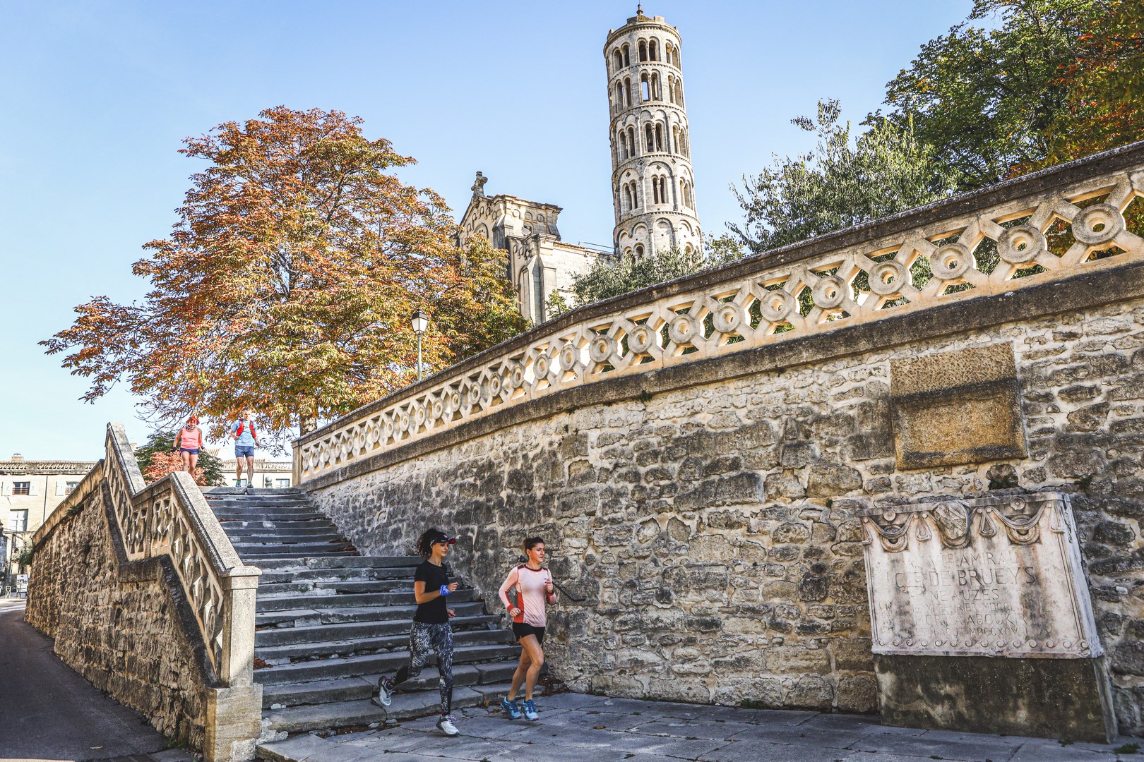
Uzès: the start isn’t arbitrary
(Photo credit: Veni Vici)
You might think Uzès was chosen as the start because the town is beautiful, because the Duchy makes for a perfect pre-race photo, because the atmosphere is there 🎉. That’s true, but it’s not the reason. The Romans chose this spot long before the Duchy existed, for a purely practical reason: the Eure springs, which surge up in the valley below, were the only ones to combine sufficient flow and an altitude slightly higher than that of Nîmes. Slightly (barely twelve meters of difference). But it was all they needed! 😎
The first kilometers follow this cool, somewhat enclosed valley that most visitors to the Gard don’t know. Here, no spectacular monument, no interpretive sign. Just the first masonry of the aqueduct surfacing among the grass—discreet, almost shy. It’s a good moment to understand that this race isn’t going to show you history: it’s going to make you cross through it 🏹.
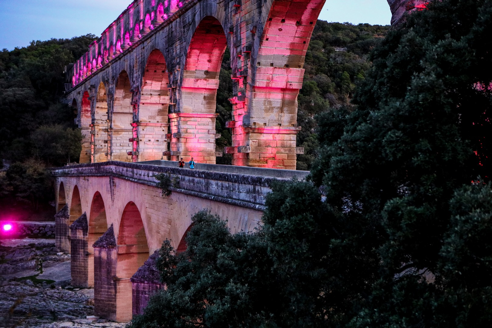
The Pont du Gard seen from inside the system
(Photo credit: Veni Vici)
Most people see the Pont du Gard from the parking lot 🅿️, from the riverbank, from a restaurant terrace... They see it as a vertical monument—majestic, photogenic 📸. Veni Vici runners see it differently, because they reach it after thirty or fifty kilometers already in their legs, having already crossed the Estel quarries in Vers-Pont-du-Gard. This is the exact spot, 600 meters downstream from the bridge, where the stones it is made of were extracted 🪨. A quarry listed as a Historic Monument that almost all visitors to the site ignore.
When you know where the stones come from, when you’ve run the distance that separates the quarry from the monument, the Pont du Gard stops being a curiosity and becomes what it is: the solution to an engineering problem. How do you carry a water channel over a river without losing the gradient? Forty-eight meters high, three levels of arches, blocks that can weigh up to six tons. It’s dizzying—or disorienting, we’re not quite sure 😅. On top of that, we can say it: it’s simply ma-gni-fi-cent! (Veni Vici runners certify it 💯). It’s a not-insignificant bonus! 🤫
Sernhac: what most runners don’t see
(Photo credit: Veni Vici)
Between Saint-Bonnet-du-Gard and Sernhac, buried in the garrigue, two tunnels carved into the rock in the 1st century remain among the least-known sites along the entire aqueduct route. Roman crews worked there from both ends at the same time, in the dark, guided by shafts dug down from the surface. On the walls you can still make out tool marks, notches for oil lamps 🪔, and sometimes slight course corrections when the two cutting faces didn’t line up perfectly. The aqueduct solved a simple problem here: it made more sense to drill through the hill than to go around it, at the risk of losing that famous gradient 🧐.
Many Veni Vici runners pass through this area without knowing exactly what they’re running alongside. No more excuses now! And then, let’s admit it, it’s always the kind of fun anecdote to share to show off at the coffee machine... or during a wild game of Trivial Pursuit! 🧀
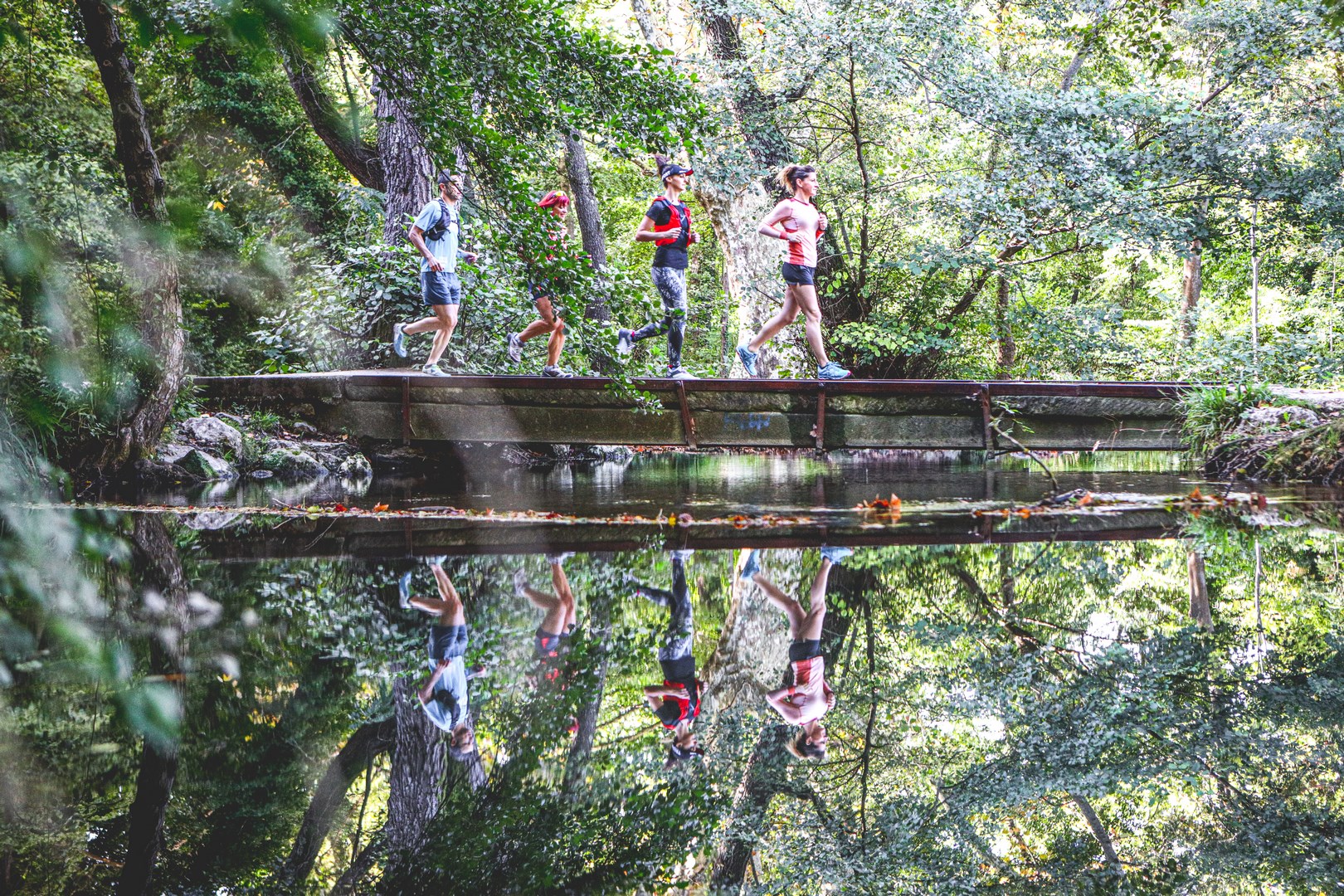
The in-between: the Gard nobody shows

(Photo credit: Veni Vici)
There’s an honesty in the Veni Vici route that you appreciate all the more as the kilometers go by: this course doesn’t take any detours just for pretty viewpoints 🏞️, no concessions to the logic of the tourist brochure. It follows the land as it is: dry garrigue, limestone ridgelines, typical Occitan villages: Castillon-du-Gard, Lédenon, Cabrières.
And yet this is where the aqueduct ran too, buried, invisible, maintaining its millimetric gradient beneath the feet of generations who followed one another without knowing. Several regular Veni Vici participants, from the region, say they discovered some of these villages on race day. There’s something quite beautiful in the idea that a sporting event could give a territory back the coherence that tourism had taken from it 🏡.
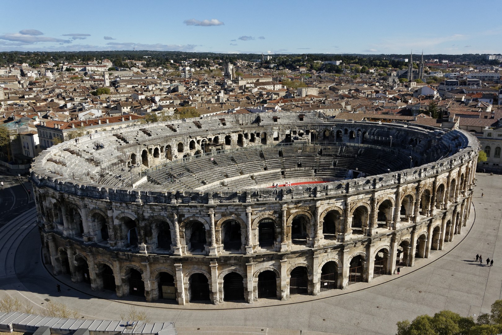
The arena: the finish was already planned
(Photo credit: Veni Vici)
The final sprint into the Nîmes arena is one of the most singular finishes in French trail running. The aqueduct’s water arrived in Nîmes in a distribution basin located a few hundred meters from the arena, from where it was delivered to the fountains ⛲️, the baths, the city’s neighborhoods. The arena, for its part, could hold 24,000 spectators in a city of 50,000 inhabitants—that’s where Roman public life was concentrated.
Finishing your race by running on the sand, beneath millennia-old vaults, with the stands all around 🏟️, is the culmination of a journey that someone calculated long before all of us, for reasons that had nothing to do with trail running and everything to do with gravity, stone, and water. You’ve arrived where the water arrived—now you can enjoy the festivities.
So, will you in turn conquer the Veni Vici next November?
A next-gen platform helping sports enthusiasts of all levels discover territories and heritage through races tailored to them.
Made in France, between Lyon and Nantes