
Trail des Étoiles 2027
- Next event : Mid-August 2027
- Last event : Sun, August 16, 2026

The event in a few words
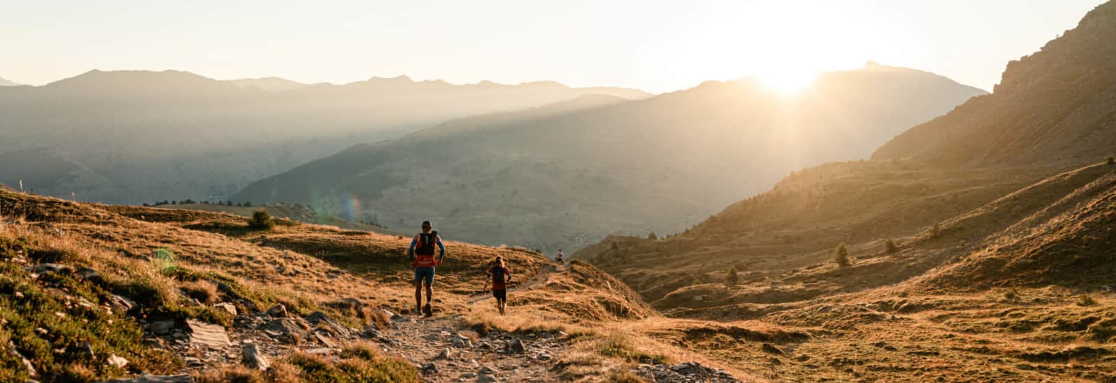
How about joining one of the highest villages in Europe for a little sporting challenge? On the border between France 🇫🇷 and Italy 🇮🇹, the municipality of Saint-Véran is officially one of the highest on our continent, with its church set at 2,042 m above sea level! 😮 And to top it off, it’s a very pretty village! 😍 A perfect setting for the aptly named Trail des Étoiles 🌟, a mountain meet-up in the middle of August. Located in the Queyras Regional Natural Park, Saint-Véran offers you a big breath of fresh, pure air 🌬️. The forests 🌳 along the route will bring you the shade you’ll need; it won’t be too much, especially at that time of year 🥵.
The Hautes-Alpes department, within the Provence-Alpes-Côte d'Azur 🌞 region, obviously offers an exceptional racing setting. The four trail routes designed by the organizers (two discovery trails of 10 km and 21 km, a short trail of 36 km and a long trail of 56 km) will take you to elevations even higher than those of the little municipality 🚩. To expect on the 56 km race: 3,700 m of positive elevation gain—something your thighs won’t forget! 😂 We love the name of the race: "La Route des Contrebandiers". Let’s see if you can pull off the heist! 🧨 Start in Molines, 400 m lower down, for a cross-border and wild route. Col des Prés de Fromage, Col des Estronques, Aigueblanche, Refuge de la Blanche, Colle Del Lupo (Col du Loup 🐺 in Italian), Pic de Caramantran... So many names that will soon resonate within you 🥰. A clash of forests 🌲, lakes 💧, high mountains 🏔️ and other gorges 💥. The route "Le tour de la tête des Toillies" is also waiting for you with its 2,200 m D+ 📈. And to aim even further, this race is a qualifier for the French Short Trail Championships and is part of the Challenge Trails Région Sud. Basically, you perform and you’re already positioning yourself for the next races 👀.
Surrounded by Savoie, Isère, Drôme and the Alpes-de-Hautes-Provences, the Hautes-Alpes department is an important place for nature lovers and travelers 🧳. Filled with prestigious peaks, this territory is the highest in France and boasts some big mountain names: Serre-Chevalier, La Meije, Montgenèvre. If you feel like resting within "civilization", head to Gap or Briançon, two of the department’s largest cities 🌆, and enjoy all their cultural and historical heritage 🏛️. Some places are more spoiled than others, and you have to admit the Hautes-Alpes have a lot to offer! The Mont-Dauphin Vauban Fortified Place is notably listed as UNESCO World Heritage, while the village of Fort Queyras is a former fortified castle 🏰. You can also go see the aptly named Petrifying Fountain of Réotier, the Tour Brune in Embrun, the Boscodon Abbey or the Clausis Chapel... And who has never heard of the magnificent Écrins National Park, Lake Serre-Ponçon or the Méouge Gorges? Nature lovers in the great outdoors 🍃 benefit here from nearly 7,000 km of marked trails! So the question isn’t "what on earth am I going to do after my race?" but rather "will I have time to do everything?" 🤪.
So, for the Republic, for the Force, for the Galaxy, and for the love of beauty, go for it! 🤺
5 reasons to join this race
A distance for every taste
56 kmTOP
36 km
21 km
10 km
- Mid-August 2027
- Elevation gain : 3700mD+
- 3 ITRA points
- 1 loopx56 km
A few more words
If long trails are your thing, then "The Smugglers' Route" is made for you! 😉
The start will be at 5 a.m. from the Clos de la Chalpes car park in Molines. You’ll begin by making a loop around the Vallon de la Selle, then you’ll move onto the flat section of the route, running over the Col du Près Fromage, then the Col Fromage 🧀. You’ll descend from the Col des Estronques and after 18 km you’ll reach your first aid station, at the Pont du Moulin. The climb back up is then via the grand canal to the Col de la Chamoussière to access the Pic de Caramantran at over 3,000 mD+ 🤯. You’ll then drop down onto the Italian side via the Colle di Veran, a natural border, to descend towards the village of Chianale, which is the 3rd aid station on this course at km 36. A purely mountain Italian aid station. The last climb (one of the most physical) goes via the lakes of Col de Longet and the very rocky Col de la Noire, perched at 2,956 meters high. To finish, the return to Saint-Véran 🏁 will gently follow the valley of the Aigue blanche. 🏃♂️
That’s it, you’ve arrived! 🏁

56 km : Smugglers' Route Relay Race
Trail- Mid-August 2027
- Elevation gain : 3700mD+
- 1 loopx56 km
A few more words
If you’re more into ultra trail and your teammate is more into short trail, then "The Smugglers' Route" as a relay is made for you!
The start will take place at 5 a.m. from the Clos de la Chalpes car park in Molines.
The first relay runner 🏃♀️ will cover 36 km with 2,300 mD+. They will complete a first loop and then head to the Col des Estronques. After refuelling, they will continue on to the Col de la Chamoussière to reach the Pic de Caramantran and its 3,000 mD+ 🏔️. Just like on the solo course, they will then cross over to the Italian side via the Colle di Veran, a natural border, to descend to the village of Chianale, which is the 3rd refreshment station and the relay handover point on this route at km 36. The 2nd relay runner hits hard with a demanding climb up to the lakes of the Col de Longet and the very rocky Col de la Noire, perched at 2,956 metres above sea level.
To finish, the return to Saint-Véran 🏁 will calmly follow the valley of the Aigue Blanche. 🏃♂️

36 km : La tête des Toillies
Trail- Mid-August 2027
- Elevation gain : 2200mD+
- 36 km
- 2 ITRA points
A few more words
Your start will be at 8 a.m. from the Clos de la Chalpes car park in Molines. To begin, you will take the climb up the Aigueblanche torrent towards the upper Blanche valley. You will then head towards the Col de la Noire, which will mark the start of the Tête des Toillies loop via the passes of Longet and Blanchet. At the end of 18 km, you will find your first aid station 🥤 at the Refuge de la Blanche. You will then run over the Col de Saint Véran, the official border with Italy 🇮🇹, and along its ridgeline before reaching the Pic de Caramantran. The high point of this race will offer you a view of Pain de Sucre and of Mont Viso. You will then descend along a balcony trail, passing the trail of the former Grand Canal. After 36 km, you will have arrived in the town of Saint Véran 🏁.

21 km : The Rasis Half Marathon
Trail- Mid-August 2027
- Elevation gain : 1350mD+
- 21 km
- 2 ITRA points
A few more words
The start will be at 8:30am from the Clos de la Chalpes car park in Molines. It is an intermediate route, without any major difficulty, and will take place in two parts. The first part will be steady. You will run to the Chapelle de Clausius. A first aid station 🥤 will be at km 6 and a second at km 18. For the second part of the race, you will descend via the small then the large canal to the finish line in Saint Véran 🏁.

10 km : L'aigueblanche
Trail- Mid-August 2027
- Elevation gain : 450mD+
- 10 km
- 1 point ITRA
A few more words
The start of the "Sprint Race" will take place at 9 a.m. from the parking lot of Clos de la Chalpes in Molines. You will run along the Aigueblanche and then you will reach Saint Véran via the small canal. It's a fast and intense uphill race 🥵.

Frequently asked questions (FAQ)
You can pick up your bib at the Molines-en-Queyras start village, located in the Clot La Chalp parking lot:
On Saturday, August 15, 2026 from 10am to 8pm. Bib pickup for the Route des Contrebandiers will only be possible on that day.
On Sunday, August 16, 2026 from 7:00 to 7:45 for the 36 km, from 7:30 to 8:15 for the 21 km, and from 8:00 to 8:45 for the 10 km.
Your bib will be given to you only upon presentation of an ID document and after the mandatory kit check.
The races will start from Molines-en-Queyras, from the Clot la Chalp parking lot:
for the "Route des Contrebandiers": at 5:00am, briefing at 4:45am
for the "Tour de la tête des Toillies": at 8:00am, briefing at 7:45am
for the "Semi du Rasis": at 8:30am, briefing at 8:15am
for "l'Aigueblanche": at 9:00am, briefing at 8:45am
Prices vary depending on the race:
For "l'Aigueblanche": €21
For the "Semi du Rasis": €32
For the "Tour de la tête des Toillies": €49
For the "Route des Contrebandiers": €72
For the "Route des Contrebandiers" Relay: €40 per participant
An aid station will be offered for all routes at the finish. You’ll find others depending on the course:
For the "Route des Contrebandiers": 4 aid stations at km 18, km 26, km 36 and km 47
For the "Tour de la tête des Toillies": 2 aid stations at km 18, km 27.
For the "Semi du Rasis": 2 aid stations at km 6 and km 18.
For "l'Aigueblanche": refreshments will be available only at the finish
You must be at least 20 years old to take part in the 21 km, 36 km and 56 km races. However, a minor may take part in "l'Aigueblanche" provided they submit parental authorization.
For the "Route des Contrebandiers":
Col Saint-Véran: 12:30pm
Village of Chianale (aid station in the village center): 1:30pm
Refuge de la Blanche: 4:45pm
Finish: 6:00pm
For the "Tour de la tête des Toillies":
1st passage at the Refuge de la Blanche: 12:00pm
2nd passage at the Refuge de la Blanche: 4:45pm
Finish: 6:00pm
For the "Semi du Rasis":
Col Prés Fromage: 10:30am
Pont du Moulin: 1:30pm
Finish: 3:00pm
No cut-off time on the last route, "l'Aigueblanche".
The list of mandatory gear varies depending on the race:
For the "Route des Contrebandiers":
Minimum 1L water reserve
Food reserve
Emergency blanket
Whistle
Personal cup
Mobile phone with charged battery
Headlamp
Waterproof windbreaker, Gore-Tex type
Pair of gloves
Beanie or cap or buff
For the "Tour de la tête des Toillies":
Minimum 1L water reserve
Food reserve
Emergency blanket
Waterproof windbreaker, Gore-Tex type
Pair of gloves
Mobile phone with charged battery
Whistle
Personal cup
Beanie or cap or buff
For the "Semi du Rasis":
Minimum 0.5L water reserve
Food reserve
Emergency blanket
Waterproof windbreaker, Gore-Tex type
Mobile phone with charged battery
Whistle
Personal cup
For the "10 km de l'Aigueblanche":
No mandatory gear
Telescopic poles will be tolerated but must be folded at the start.
Depending on the weather conditions on race day, the equipment in the Heatwave Kit or the Extreme Cold Kit may become mandatory.
Your registration includes:
the bib
the finish snack
liquid and solid race refreshments
a welcome gift
a finisher T-shirt
If you want to lend a hand, you can contact the organizers by filling out a contact form in the "volunteer" section of the website or by sending an email to traildesetoiles@gmail.com
Prizes will be awarded to the top 3 men overall and the top 3 women overall in each race.
For the DUO relay of the "Route des Contrebandiers", prizes will be offered only to:
First team in the overall ranking
First women’s team
Free shuttles linking Molines to Saint Véran will be available from 10am to 6pm. The shuttle departure location, which is in the parking lot at the bottom of the village, will be indicated by specific signage.
Do you have other questions? You can contact the organizers:
by filling out a contact form
by phone: 06 28 65 24 56
You can check the race rules here
Focus


A next-gen platform helping sports enthusiasts of all levels discover territories and heritage through races tailored to them.
Made in France, between Lyon and Nantes